About Mount Kailash
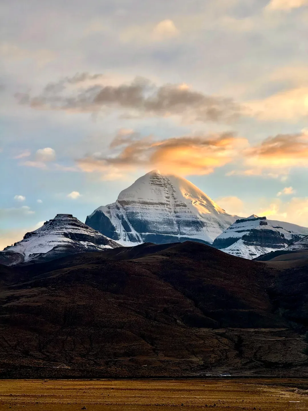
Mount Kailash stands alone in western Tibet, a black pyramid of rock and ice rising from the Tibetan Plateau. No climber has ever stood on its summit — not for lack of ability, but because it is considered too sacred to touch. For centuries, pilgrims have walked the 52-kilometer kora around its base, believing a single circuit erases the sins of a lifetime. The mountain’s four nearly symmetrical faces align with the cardinal directions, a geological coincidence that has fueled its mystique for millennia.
Mountain Facts
Protected Area
Kailash Range
UNESCO Status
Not designated
Our Ratings
Scenery 5/5 · Hiking 5/5 · Culture 5/5 · Access 2/5
Cultural Significance
Sacred to Buddhism, Hinduism, Jainism, and Bon — the axis mundi of four religions. The 52km circumambulation (kora) is one of the world’s great pilgrimages.
Highlights
- • 52km kora trek around the entire mountain
- • Dolma La Pass at 5,630m — the kora’s high point
- • Lake Manasarovar, one of the highest freshwater lakes on Earth
- • Sunrise reflections of Kailash in Lake Manasarovar
- • Tibetan Buddhist monasteries along the kora route
When to Go
May-June and September-October: The kora is only passable in these windows. July-August brings monsoon rain and mud. November-April the pass is snowed shut. Acclimatize in Lhasa (3,650m) or Darchen (4,575m) for 2-3 days before starting. The kora takes most people 3 days with overnight stays at Drirapuk and Zutulpuk monasteries. Altitude sickness is the primary risk — the entire walk is above 4,500m with the pass at 5,630m.
How to Get There
The journey is an expedition in itself. Fly to Lhasa, then drive 4 days via the G219 highway through Shigatse and Saga, or fly to Ali Kunsha Airport (NGQ) and drive 5 hours. Most visitors join organized tours that include the Tibet Travel Permit, transport, and guide. Independent travel to Kailash requires the same permits plus substantial planning. The nearest town with basic services is Darchen.
Frequently Asked Questions
Can you climb Mount Kailash? +
No. Climbing is prohibited by the Chinese government out of respect for religious beliefs. No successful ascent has ever been recorded. The mountain is considered too sacred by Tibetan Buddhists, Hindus, Jains, and Bon practitioners to be climbed. Even touching the mountain above the base is discouraged.
How difficult is the Kailash kora? +
Extreme due to altitude, not terrain. The 52km trail is well-trodden with no technical sections, but you are walking at 4,500-5,630m elevation where oxygen is roughly 50% of sea level. Fit trekkers in their 20s can complete it in 2 days. Most people take 3 days. Some pilgrims complete it in a single 18-hour push. Horses and porters are available for hire at Darchen.
Do I need a permit to visit Kailash? +
Yes. You need a Tibet Travel Permit (issued only through registered tour operators), an Alien Travel Permit for the Ngari region, and a Military Permit for the border area. All must be arranged through an agency before arrival. Individual travel to Kailash is technically possible but bureaucratically challenging.
What is the best month for the Kailash kora? +
September is ideal — stable weather, clear skies, and post-monsoon clarity give the best views of the mountain. May-June offers wildflowers and slightly warmer temperatures. Avoid July-August (monsoon) and November-March (snow closes the Dolma La Pass).
How do I prepare for the altitude? +
Spend at least 3 days acclimatizing in Lhasa (3,650m) before heading west. The drive to Kailash involves crossing passes above 5,000m which helps with gradual acclimatization. Bring Diamox as a precaution. Hydrate aggressively — 4-5 liters of water per day at this altitude. Symptoms of altitude sickness include headache, nausea, and dizziness. Descend immediately if symptoms worsen.
What should I pack for the kora? +
Layers for temperatures from 20 C (day) to -10 C (night at Drirapuk), sturdy hiking boots, sleeping bag rated to -10 C, headlamp, sunscreen (UV at 5,000m is brutal), water purification tablets, high-calorie snacks, and cash (no ATMs for hundreds of kilometers). A hiking pole helps enormously on the Dolma La descent. Guesthouses along the route provide basic meals and thin mattresses.
Is there accommodation on the kora route? +
Yes, basic guesthouses exist at Drirapuk (Day 1 stop) and Zutulpuk (Day 2 stop). Both offer dormitory beds, simple Tibetan meals (tsampa, noodle soup, butter tea), and limited electricity from generators. Expect squat toilets and no showers. Sleeping bags are essential — the provided blankets are questionable.